
Table Of Contents
Previous topic
7. Map Design with Print Composer
Next topic
1. Install InaSAFE Plugin from QGIS Repository
7. Map Design with Print Composer
1. Install InaSAFE Plugin from QGIS Repository
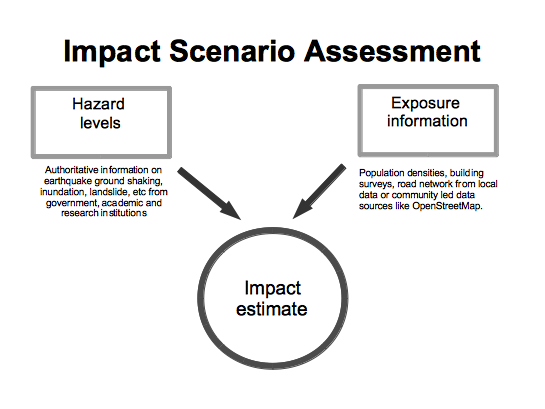
InaSAFE is a plugin for QGIS. It aims to produce realistic natural hazard impact scenarios for better planning, preparedness and response activities, using hazard and exposure geographic data.
During this training, you will explore the different components of InaSAFE plugin and their usage for an easy-to-use risk and impact scenarios assessments.
To effectively prepare for future floods, earthquakes or tsunami you must first understand the likely impacts that need to be managed. For example, to prepare contingency plans for a severe flood, emergency managers need to answer questions like:
InaSAFE provides a simple but rigorous way to combine data from scientists, local governments and communities to provide insights into the likely impacts of future disaster events. The software is focused on examining, in detail, the impacts by a single hazard would have on specific sectors.
At the end of this material, you will be able to: